Contents
1.Basic Information
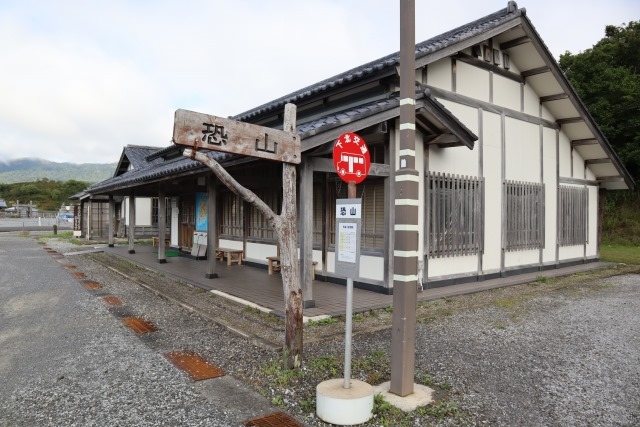
Osorezan (Osore Mountain)
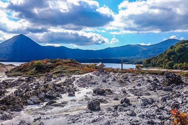
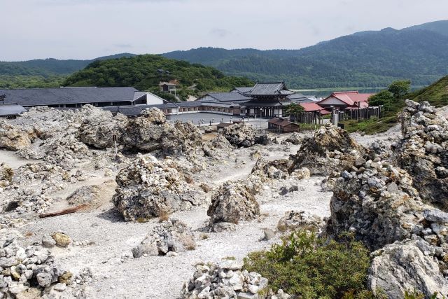
Osorezan, situated in the central part of the Shimokita Peninsula, is an active volcano. Beside it lies the caldera lake, Usoriko. On its shores, there exists Bodaiji, one of the three major spiritual sites in Japan, with a hot spring inside.
Osorezan Bodaiji (Osorezan Bodai Temple)
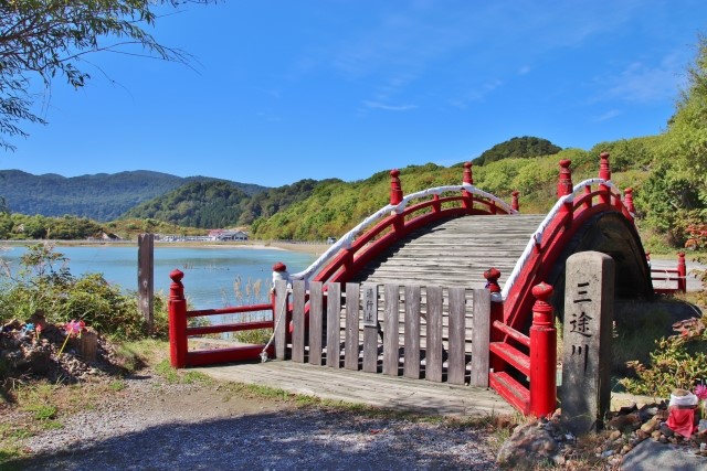
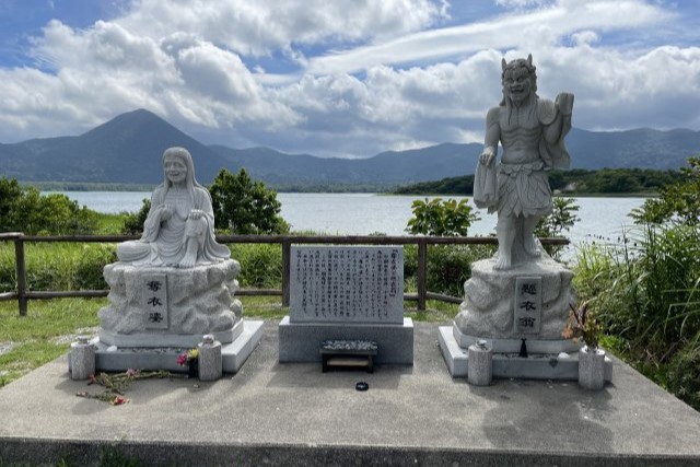
Osorezan is recognized as one of the three major spiritual mountains in Japan and was founded in 862 by Jikaku Daishi. Known as a sacred site of the Tendai sect, it features landscapes symbolic of the afterlife, such as “Sanzu no Kawa”, “Jigoku Tani”, and “Sai no Kawara”. The entire area is filled with the scent of sulfur, drawing visitors to its mystical ambiance.
Itako
Itakos are priestesses from the Tohoku region of Japan. Historically, women with weak eyesight often became Itakos. They are believed to have the ability to communicate with the spirits of the deceased, a ritual known as “Kuchiyose”, especially famous in Osorezan. However, with changing times, fewer people are choosing to become Itakos, and many of the current Itakos are elderly.
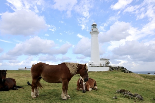
Shiriyasaki Lighthouse
From Japan’s tallest brick-built lighthouse, you can overlook the Tsugaru Strait. This historic building is known for having Japan’s first electric light and foghorn. Nearby, the region-specific farm horse, Kandachime, is pastured in the meadows.
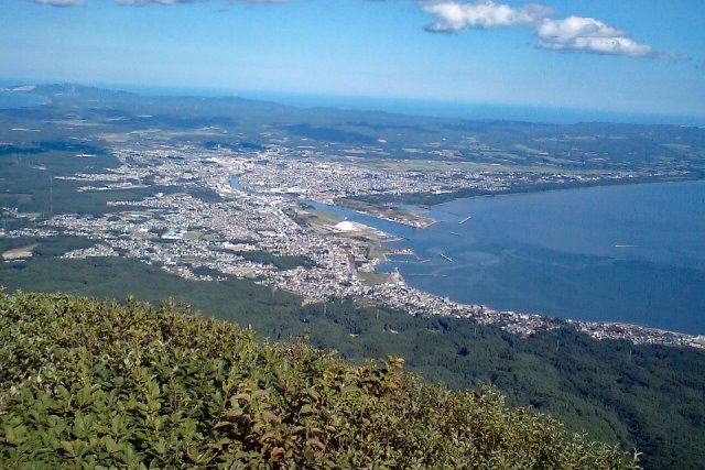
Kamahuseyama
From the observation deck of Kamahuseyama, one can gaze upon the Mutsu cityscape, the surrounding nature, and even Hokkaido on clear days. At night, the sparkling city lights resemble the shape of a swallowtail butterfly.
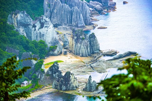
Hotokegaura
Hotokegaura features a row of powerful and peculiar rocks stretching over 2 kilometers. The contrast between the mystic rocks and the blue sea creates a breathtaking view, believed to have originated from the volcanic activities approximately 20 million years ago. Tourists can also enjoy this magnificent view from the sea using sightseeing boats.
2.Reviews
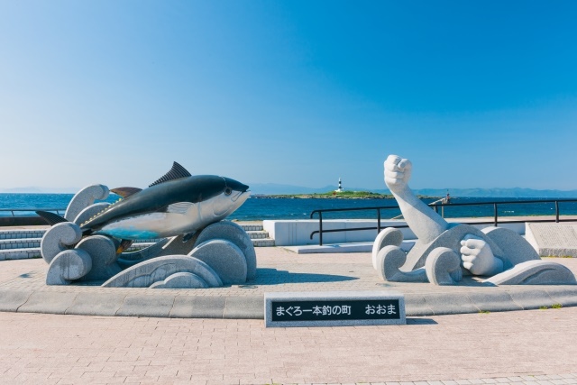
Oma’s Tuna
At the northernmost tip of Honshu, in Oma Cape, you can view Hokkaido across the Tsugaru Strait. Tuna fishing, a tradition from late August to the beginning of the new year, is a hallmark of this region. With a bit of luck, you might witness the landing of a giant tuna.
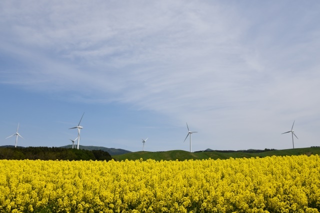
Rape Blossom Field
The rape blossom fields facing the Mutsu Bay in Yokohama town are among the largest in Japan. The golden blanket of blossoms contrasted with white windmills is truly captivating.
3.Local Food


4.Transportation Information
■How to get to Shimokita Peninsula
Aomori Prefecture Tourism Information Site (available in English, Korean, Simplified and Traditional Chinese)
https://aomori-tourism.com/access/index.html
■How to get to Osorezan
43 minutes by direct bus from Shimokita Station to Osorezan
http://www.0175.co.jp/s/s-bus/osorezan-other.pdf
5.Map Information
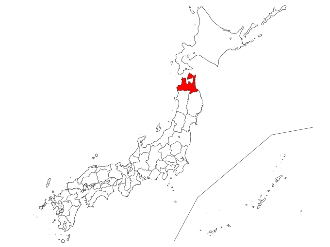
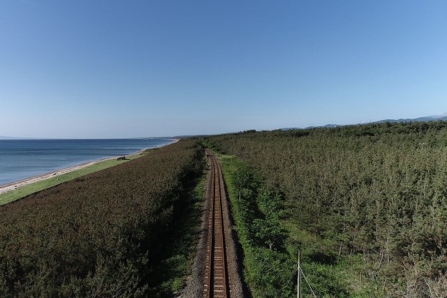
The Shimokita Peninsula, located at the northernmost tip of Aomori Prefecture, is surrounded by the Pacific Ocean, the Tsugaru Strait, and the Mutsu Bay. Resembling the shape of an axe, it is also known as the northernmost habitat for primates on Earth, excluding humans, where the Japanese macaques thrive.