Contents
1.Basic Information
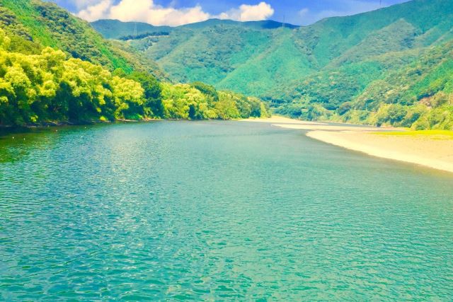
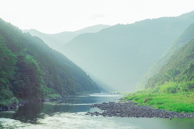
The Shimanto River is the longest river in Shikoku, flowing through the western part of Kochi Prefecture. There are no dams in the river basin, and it is known as the “last clear stream in Japan”. It is called one of the “three major clear streams in Japan” along with the Kakita River and Nagara River. It has been selected as one of the 100 best water sources and hidden places in Japan. You can experience various activities on the Shimanto River, from canoeing to leisurely sightseeing by boat along the river.
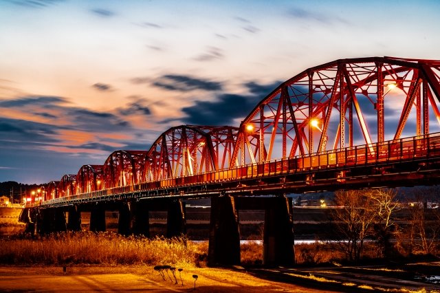
Red Iron Bridge
The Shimanto River Bridge, affectionately known as the Red Iron Bridge, has become a symbol for local residents. The history of this bridge dates back to 1926, when it was built in response to a ship capsizing incident during a time when the Shimanto River was prone to flooding and the only means of transport was by ferry.
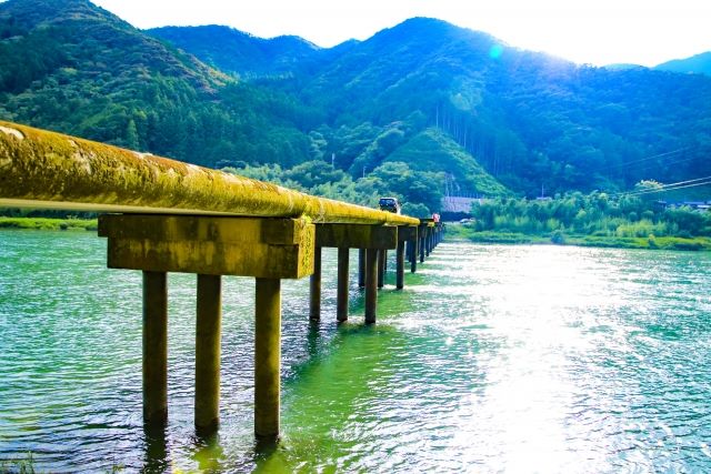
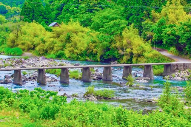
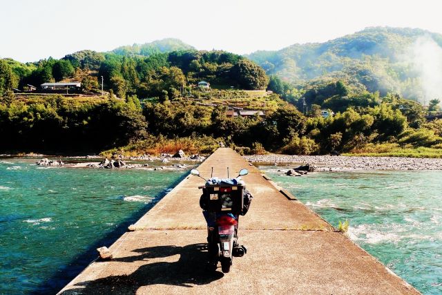
Submersible Bridge (Chinkabashi)
A submersible bridge is a bridge without handrails, so if the water level rises and the bridge is submerged, it cannot be blocked by driftwood or sediment. This structure prevents the bridge from being destroyed and flooding.
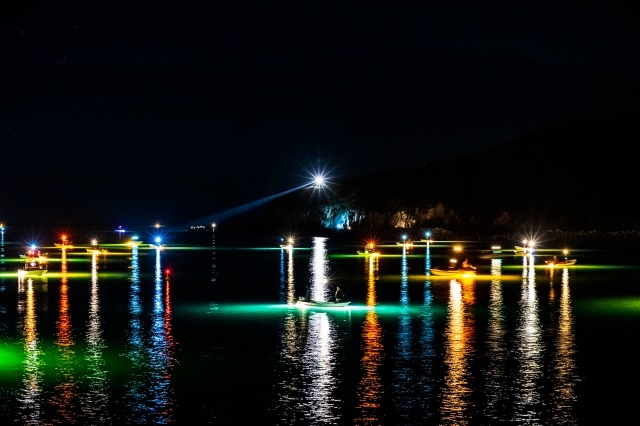
Glass Eel Fishing
Glass eel fishing on the Shimanto River is known not only for the capture of rare wild eels, but also for its beautiful sight. The colorful lights reflect on the dark river surface, creating a fantastical landscape. Eel fry are so valuable that they are called “white diamonds”, and this fishery requires the permission of the prefectural governor.
2.Reviews
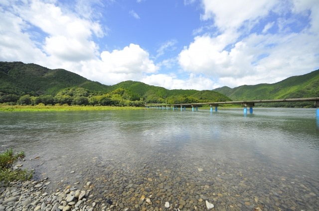
The Shimanto River, one of Japan’s three major clear streams and approximately 196km long, has many submersible bridges. We recommend a trip to visit these bridges, such as the Sada and Kachima submersible bridges. These bridges are also used as filming locations.
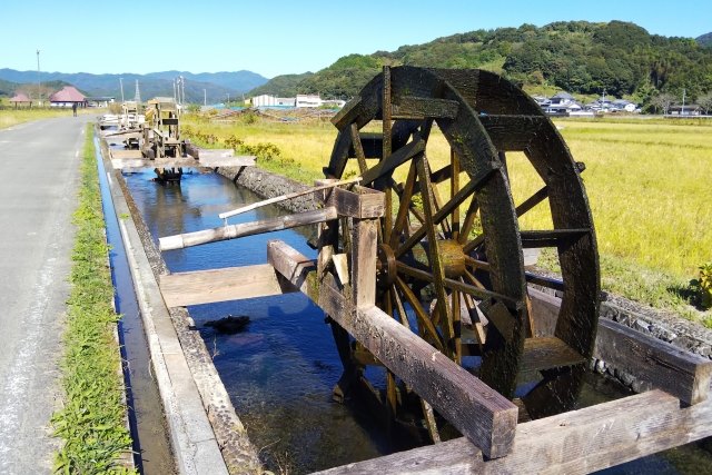
Take a 15-minute bus ride from Nakamura Station and get off at Anami. There you will find the nostalgic “Anami Watermill Village”. These waterwheels were built during the Edo period to irrigate paddy fields. In late May, hydrangeas bloom along the waterways, providing a beautiful scenery with the waterwheels.
3.Local Food


4.Transportation Information
It takes approximately 1 hour and 40 minutes from Kochi Station to Nakamura Station on the Limited Express Ashizuri. You can tour the Shimanto River by bus, taxi, rental car, or rental bicycle from Nakamura Station.

5.Map Information
Shimanto City is a central city in western Kochi Prefecture, with the third largest population in the prefecture. The city center is formed by the Nakamura Plain, which is spread out by the Shimanto River. Summers can be harsh in the inland areas, and the highest temperature of 41.0°C was recorded in 2013. Until a temperature of 41.1°C was observed in Kumagaya City, Saitama Prefecture in 2018, it held the record for the highest temperature in the country.