Contents
1.Basic Information
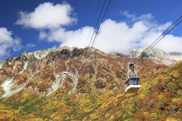
The Tateyama Kurobe Alpine Route is a globally renowned mountain sightseeing route. It stretches over 37.2 km with a maximum elevation difference of 1,975 meters. This route goes from Tateyama Station in Toyama Prefecture to Ogizawa Station in Nagano Prefecture, and involves various modes of transport such as cable cars, ropeways, and buses. Along the way, visitors can enjoy beautiful natural landscapes.
Tateyama
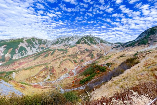
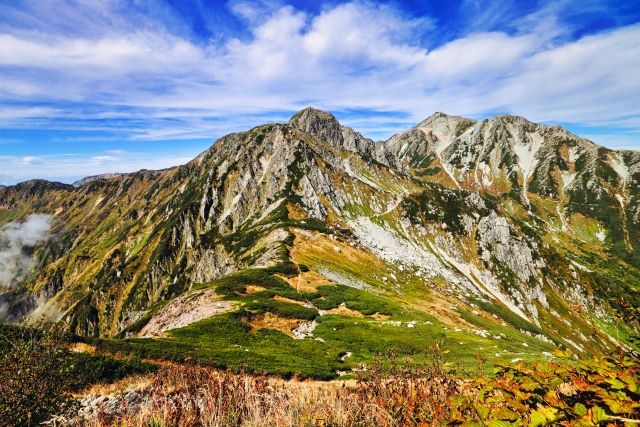
Tateyama consists of three main peaks: Oyama (3,003m), Oonanjiyama (3,015m), and Fujinooritate (2,999m). It is one of Japan’s “Three Holy Mountains,” alongside Mount Fuji and Mount Hakusan, and has been of religious importance since ancient times.
Murodō Terminal
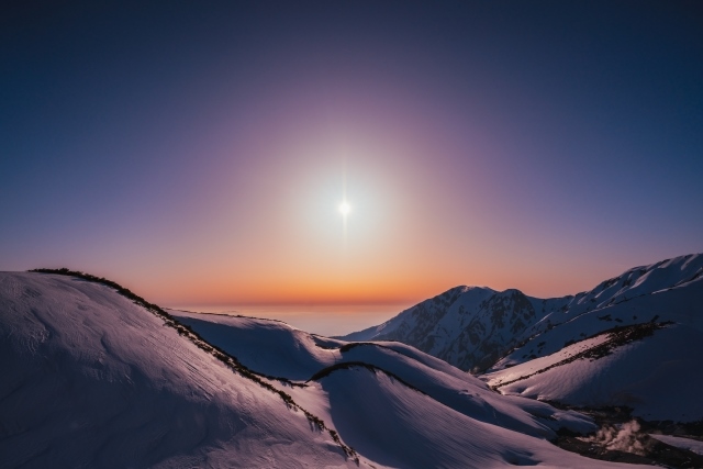
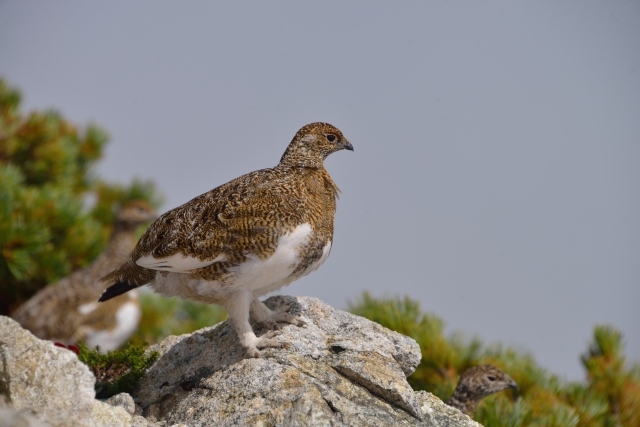
You can reach Murodō, at an elevation of 2,450 meters, in about an hour by cable car and bus. The summer season is short, with snow melting starting in early July and the first snowfall occurring from late September to early October. The area is popular with hikers and also offers a chance to see the ptarmigan, a bird designated as a Special Natural Monument, and alpine flora. The terminal has various facilities, including hotels, shops, restaurants, and a simple post office.
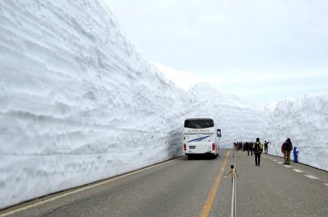
Snow Canyon (Yuki no Ootani)
Tateyama is one of Japan’s most snow-heavy areas. The snow walls formed during snow removal work near the Murodō Terminal can exceed 20 meters in height and stretch for about 500 meters. An event where people can walk alongside these towering walls of snow is held every spring.
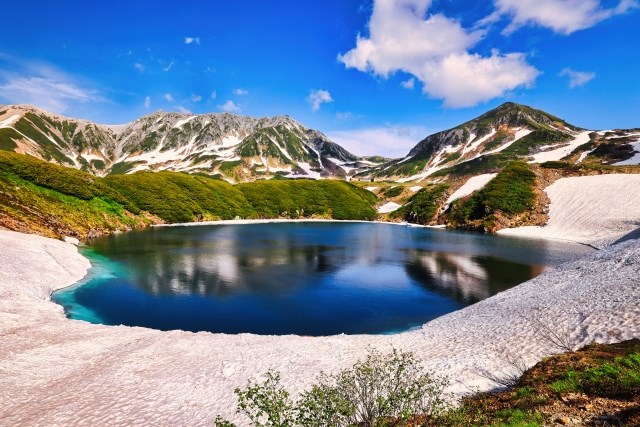
Mikurigaike
Mikurigaike is a volcanic lake formed about 10,000 years ago. The lake has a circumference of approximately 630 meters and a depth of about 15 meters. It offers breathtaking views all year round, especially between July and October, when the lake’s surface reflects the surrounding majestic mountains.
Ptarmigan (Raityou)
This endangered species, often called a “living fossil,” changes its feathers from brown in summer to white in winter. Normally shy, they are more likely to be seen on rainy or foggy days. The ptarmigan is also considered a symbol of Toyama Prefecture and is thought of as a “messenger of the gods.”
2.Reviews
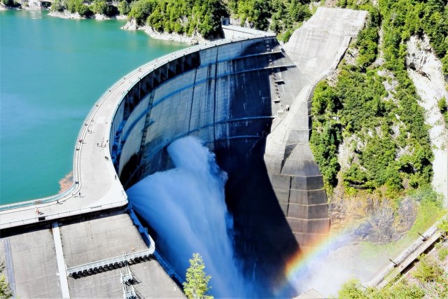
Kurobe Dam
Kurobe Dam is one of the largest dams in Japan, built over seven years from 1956 to 1963 at the cost of 51.3 billion yen and the labor of 10 million workers. A highlight of the dam is the powerful discharge of water from Kurobe Lake, which can create a rainbow on clear summer days, best viewed in the morning.
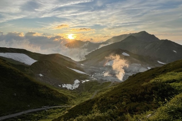
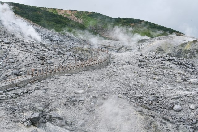
Hell Valley (Jigokudani)
Though entry to Hell Valley is prohibited due to volcanic gases and sulfur vents, nearby are the crystal blue Mikurigaike and the “Blood Pond” with its red waters. This valley was seen as a representation of hell during the Edo period when the belief in Tateyama as a religious object became widespread.
3.Local Food

4.Transportation Information
Access to the starting point of climbing Tateyama, Murodō at 2,450 meters, is possible through various means of transportation such as ropeways, cable cars, and buses.
Official Tateyama Kurobe Alpine Route website (Multi-language support)
https://www.alpen-route.com/access_new/access/
5.Map Information
Tateyama has three main peaks and is one of the rare mountains in Japan with glaciers. The summer is extremely short, with snow-free periods only from July to mid-September. In winter, winds from Siberia carry moisture from the Sea of Japan, resulting in heavy snowfall. This region is one of the world’s most snow-prone areas, with snow depths exceeding 15 meters and temperatures sometimes dropping below -20°C.